


Pirin is a mountain of a distinct alpine type – harsh, steep, filled with rocky edges and deep cirques. Any exit from Bansko to the higher parts requires respect and knowledge of mountain terminology. Let’s take a closer look at the key difference between a route and a trail and why this knowledge can save you a lot of trouble.
What exactly is a mountain trail?
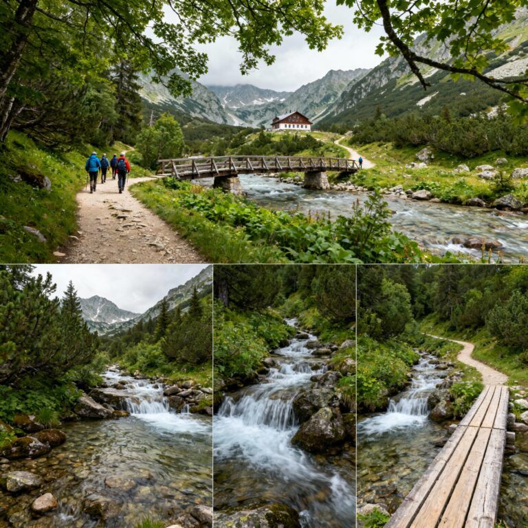
The trail is the purely physical trace on the terrain. It is formed naturally by the repeated passage of people, and very often animals – wild goats, herds of sheep or cows – over the years. The path is what your eyes see as the trampled ground in front of you.
- Features: The path can be a trodden dirt path in the forest, a narrow clearing through dense stands of spruce, or simply a series of more stable stones polished by footsteps passing through scree (moraines).
- Specifics in Pirin: The area above Bansko and Dobrinishte is full of so-called “goat trails” or old, long-abandoned shepherd’s paths. They are extremely misleading. They start as clear and wide tracks, but often end suddenly in an impassable ravine, a sheer cliff or on the edge of a dangerous precipice.
What is a tourist route and why is it important?
Unlike the path, A route is a planned, established, and logical direction of travel from point A to point B. It is a conceptual line that tourists follow to safely reach a given destination – for example, Vihren Peak, Demyanitsa Hut or Tevno Lake.
- Features: Official tourist routes are always marked. Summer markings consist of strips of paint (red, yellow, green or blue, bordered with white) on stones and trees. Winter markings consist of tall metal stakes in yellow and black. The routes are described in official tourist maps, have an estimated average crossing time and are maintained by the Bulgarian Tourist Union (BTU) or the Directorate of Pirin National Park.
- Complexity: A mountain route in Pirin can pass through many different paths, include dirt roads, and sometimes pass through sections where there is no path at all - for example, climbing boulders or passing along protected edges such as the famous The horse.
Tips/Info: How to read the marking?
In Bulgaria, the main hiking route is usually with red marking (for example, the international route E4, which passes through Pirin). The deviations to huts and neighboring valleys are in yellow, green or blue. Always carry an up-to-date paper map of Pirin, even if you have a GPS on your phone, because the batteries drain quickly from the cold at high altitude.
Quick Comparison: Similarities and Differences
Although every route almost always follows some kind of path, remember well: not every trail is part of a route.
| Characteristics | Tourist Route | Mountain Trail |
|---|---|---|
| Essence | Plan and logical direction of movement | Physical footprint on the ground |
| Marking | Yes (color summer or color winter) | No (unless it coincides with an official route) |
| Safety | High (the safest and most passable route is chosen) | Variable (can be extremely dangerous) |
| Orientation | Easy (you follow the established signs) | Requires serious experience, GPS and knowledge of the terrain |
| Customer Support | It is periodically cleared of fallen trees and brush. | I leave it entirely to the elements. |
Practical examples: Up from Bansko
To make it even clearer, let's look at what the two concepts look like in practice when you leave Bansko for the heart of the mountain:
Example of a Route: You leave from Vihren hut (which you reached by car or bus from Bansko) towards the top peak Vihren. You follow the red marked route. This route takes you along a pre-planned path that avoids the most dangerous rocky scree and is tailored to the capabilities of the mass, well-equipped tourist.
Example of a Path: While walking along the route to Vihren, you suddenly see a small, untrodden path that branches off sharply to the side towards the area. The Kazanites. This is most likely a trail made by wild goats or maintained unofficially by climbers heading to the North Face for climbing. If you follow it out of curiosity, without alpine equipment and specific experience, you risk quickly finding yourself on a steep rock section from which it is very difficult to return.
Attention / Important: The Golden Rule of Pirin
Getting lost off the marked route is one of the most common reasons for rescue operations by the Mountain Rescue Service (MSS) – Bansko detachment. When a person “takes the wrong path”, he often falls into the so-called “traps” of the mountain – chutes that seem passable from above, but become increasingly steep and end with sheer cliffs, from which descending or returning back becomes absolutely impossible without a rope. Always follow the official marked routes! Use unmarked trails only with a licensed mountain guide.
Equipment and preparation for the routes above Bansko
Regardless of whether you choose a short route to Muratovo Lake or a tough hike to the Tevno Lake shelter, Pirin does not forgive a lack of preparation. It is mandatory to be equipped with sturdy hiking shoes (marathons for running or walking in the park are extremely unsuitable for the Pirin stones). Bring enough water, because in the high karst parts of Pirin, water sources are rare. And don't forget outerwear - Bansko was liberated over Bansko can change from sunny and hot to thunderstorm and hail in just 30 minutes.
Now that you know the difference, you are one step closer to a safe and unforgettable experience in the mountains. Bansko awaits you as the perfect starting point for your adventures!