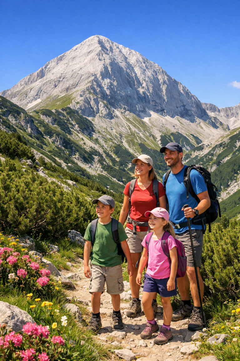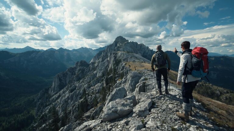
We are all used to relying on technology. Smartphones are our maps, compasses and connection to the world. But in the harsh conditions of the mountains, batteries drain surprisingly quickly, the cold literally "eats" the charge, and moving along the moraines carries the risk of your phone slipping and breaking on the rocks. At this critical moment, it is only you, your knowledge and the mountain that remain. Then the right orienteering in Pirin is turning from a tourist skill into a matter of survival.
If this happens, your ability to read the signs on trees and rocks, as well as your orientation by the sun and the peaks, is the only thing that will get you home in Bansko. Here is the most important guide on how to read the “road signs” of the Pirin Mountains.
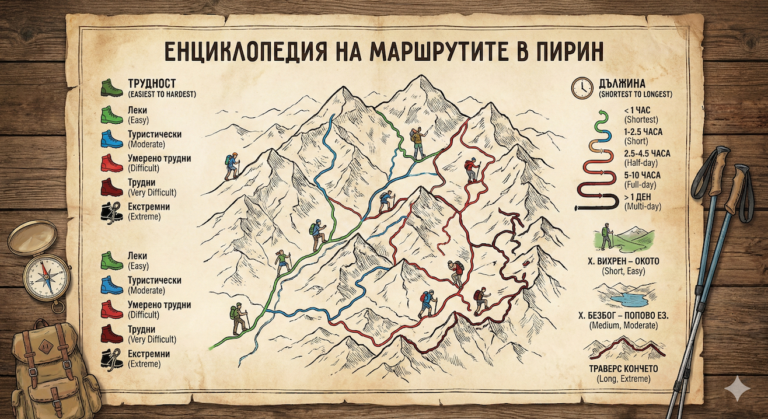
1. Summer marking in Pirin: The language of colors
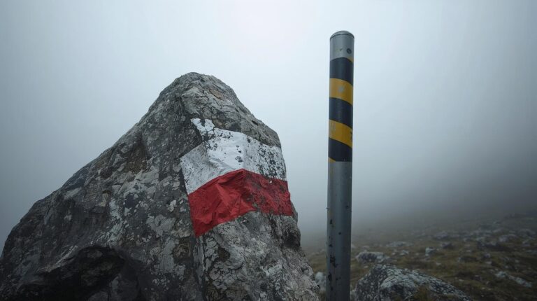
In Bulgaria, and in particular in Pirin, a standard strip marking is used for summer routes. It is a colored strip enclosed by two white stripes (shaped like a sandwich: White-Color-White). This paint is carefully applied to trees, large stones (moraines) or special poles. It is important to know that the color of the summer marking does not indicate the difficulty of the route (as is the case with ski slopes), but its function and importance in the network of trails.
| Ribbon color | Route meaning and type | A popular example in Pirin |
|---|---|---|
| RED | Main ridge routes. They cross the entire mountain lengthwise. | The international route E4: Predel hut – Vihren hut – Tevno Lake – Pirin hut. |
| BLUE | Main connecting routes, usually along the North-South axis or along river valleys. | Bansko town – Vihren hut (through the forest). |
| YELLOW / GREEN | Access paths from settlements to huts or connections between neighboring valleys. | The trail from Demyanitsa hut to Vihren hut. |
2. Winter marking: Life-saving stakes
This is perhaps the most important lesson for safe orienteering in Pirin. The summer markings placed on the stones completely disappear under the thick snow cover. Then the Winter (or azimuth) markings come to the rescue. They are tall metal stakes, painted in black and yellow stripes, which are driven deep into the ground or into massive cement foundations.
⚠️ Warning: The life-saving difference between a summer and winter trail!
In Pirin, the summer and winter trails RARELY MATCH in the high alpine part! The summer trail (marked with paint) often “cuts” (runs diagonally) the steep slopes to make walking easier. In winter, however, these slopes are extremely avalanche-prone! The winter trail (marked with stakes) runs along the very ridge (edge) of the mountain, where the wind blows the snow away and the danger of avalanches is minimized.
GOLDEN RULE: If there is snow, follow ONLY the poles! Never follow the summer marking paint, even if the wind has partially exposed it!
The signs on the stakes (Azimuth)
If you look closely, you will notice that some of the stakes have small metal plates with numbers on them (for example: I 240° / 150 m). This is information intended for navigating in Pirin in thick fog using a compass. It literally tells you: “Walk exactly 150 meters at 240 degrees to find the next stake in zero visibility conditions”.
3. Orienteering in Pirin without a phone: Where is North?
The phone died. You don't have a compass in your backpack. You lost the markings in the squat. Panic is starting to creep in. How do you find out where Bansko is and how to get home safely? Use nature.
A. The “Big Hole” Method (Landmark Orientation)
If you are in the high part of the Northern Pirin (the area around the peaks of Vihren, Todorka, Polezhan or Kutelo), geography works in your favor:
- Search the valley: Look down. If the weather is clear, you will see a huge, flat valley with towns and villages. This is the Razlog Valley, where Bansko, Razlog and Banya are located. This valley it is always NORTH (or Northeast) relative to the alpine part of the mountain.
- Neighboring mountains: If you see tall, massive mountains on the other side of this valley – that's Rila (again heading North).
- The southern view: If you look in the opposite direction and see an endless “sea” of lower mountains flowing into each other to the south – these are the Slavyanka and Rhodope Mountains.
B. The Sun as the Most Accurate Clock and Compass
The sun never lies, as long as you know how to read its path across the sky. Remember this simple diagram for orientation in Pirin relative to Bansko:
- Morning (East): The sun rises from the Rhodope Mountains.
- Lunch 12:00-13:00 (South): The sun is at its highest point and points geographically South. If you stand with your back to it at noon, your own shadow points directly North (towards Bansko).
- Evening (West): The sun sets behind the mighty peaks of Vihren and The horse (if you are looking at it from Bansko) or towards the Struma River valley.
C. Warning: The moss myth!
Forget what you learned in school! The rule “Moss always grows on the north side of trees” is dangerously misleading in real conditions. In the deep forests of Pirin (especially around the Demyanitsa and Banderitsa rivers) the humidity is high and moss grows literally everywhere. Never bet your life on this “compass”.
4. The STOP Rule: Salvation if you get lost
The greatest enemy of a lost hiker is not the cold or lack of food, but panic. It leads to aimless running, exhaustion, and fatal mistakes. If you realize you don't know where you are, immediately apply the international rule STOP.:
- S (Sit) – Sit down and stop immediately. Take a deep breath. Drink some water. Eat some chocolate. The adrenaline at this point makes you do stupid things and rush. Calm your heart rate.
- T (Think) – Think analytically. When was the last time you were absolutely sure you saw a marking? 10 minutes ago or two hours ago? How fast have you been moving since then?
- O (Observe) – Observe the surroundings. Do you see a peak that you recognize for sure? Do you hear the sound of a river or a road? Do you see the valley of Bansko and Razlog?
- P (Plan) – Plan your next move. If you have enough daylight, try to slowly retrace your own steps to the last marked trail you saw. If it gets dark quickly or you are too exhausted, stop and prepare to bivouac (use the lifesaving aluminum foil from your first aid kit to retain body heat).
One last, vital piece of advice for Pirin
The general rule in most mountains is: “If you get lost, go downstream - it always leads to civilization”. In Pirin, this rule can be deadly!
Pirin is an extremely steep mountain with an alpine relief. The water does indeed lead to the valleys, but the rivers here often pass through sheer rock ledges, impassable gorges and dangerous waterfalls. It is much safer to hold the ridge (the high part of the ridge) to have visibility and a chance to find a marked trail than to descend blindly into an unknown, overgrown with squat and cut ravine.
The mountain is beautiful, but it demands respect. Always research your route in advance, bring a paper map, a power bank for your phone, and don't overestimate your capabilities. Share this Pirin orienteering guide with your friends – it could save someone's life!