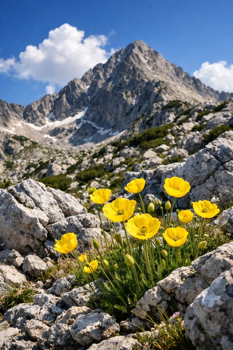
Пирин не е просто планина – тя е характер. Със своите мраморни гиганти на север и гранитни крепости на юг, планината над Bansko предлага емоция за всеки. Независимо дали сте семейство с деца, търсещо прохлада, или опитен алпинист, жадуващ за адреналин, изборът на правилните routes in Pirin is the key to an unforgettable experience.
In this encyclopedia, we have collected and classified all the main marked trails. Our goal is to help you realistically assess your options and choose a hike that will bring you pleasure, not risk.
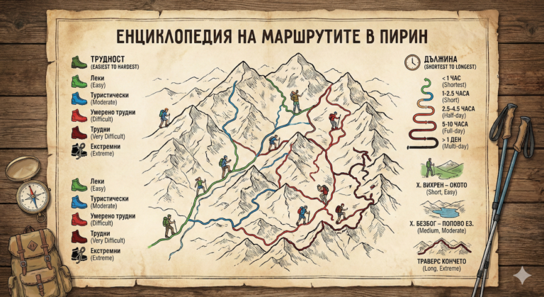
Part 1: DIFFICULTY Ranking
This ranking takes into account the technical complexity, the type of terrain (earth, rocks, scree) and the “danger” factor (exposure and precipices).
Level 1: Easy walks (Green) 🟢
Suitable for absolutely everyone – families with small children, the elderly and beginners. The terrain is mostly flat or with minimal slope.
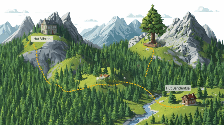
- Байкушевата мура (от х. Бъндерица): The most accessible landmark. A short path with stairs leads to the ancient tree. A must-see photo stop.
- Vihren Hut – Езеро „Окото“: Only 20-30 minutes from the parking lot. The path is made of beaten earth, and the lake is small, but extremely deep and beautiful.
- Popina Laka – Popina Laka Waterfall: It is located above Sandanski, access is almost to the asphalt road. Ideal for a picnic and coolness.
- “Todorova Ornitsa” area – Demyanitsa Hut: A long (about 3 hours), but very smooth hike along a forest road by the river. There are no steep sections.
- Gotse Delchev Hut – Хижа Безбог (пеша): If the lift is not working or you want a walk in the forest. The path is steep in places, but completely safe.
Level 2: Hiking (Blue) 🔵
They require comfortable hiking shoes and basic physical fitness. There are no technically difficult or dangerous sections.
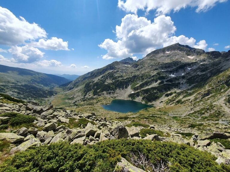
- Bezbog Hut – Popovo Lake: The classic of Pirin. The trail has a slight elevation gain (except for the “Soul Trap” at the beginning and end), passes by squats and stones. The largest and deepest lake in the mountain.
- Vihren Hut – Muratovo Lake: A picturesque route along the river that enters one of the most beautiful cirques. Ideal for a first serious contact with the mountains.
- Vihren Hut – Fish Lake (Banderishki Lakes): A light and pleasant walk in the open part of the Banderishki Circus.
- Begovitsa Hut – Pirin Hut: A transition in the low mountain belt, connecting the two emblematic huts in the Sandanski share.
- Yavorov Hut – Haidushka meadow: A walk in the lower, forested part of the Razlog Valley.
Level 3: Moderately difficult (Red) 🔴
Serious elevation gain, crossing moraines (stone rivers) and scree. Good physical fitness and endurance are required.
- Bezbog Hut – Bezbog Peak: A short (about 1 hour) but intense climb over rocky terrain. The view from the top of the lake is phenomenal.
- Vihren Hut – Sinanitsa Hut: A long hike that includes climbing Banderishka Gate and descending to one of the bluest lakes in Pirin.
- Bezbog Hut – Polezhan Peak: The highest granite peak. The path runs along large stone slabs. It is steep, but there are no precipices.
- Попово езеро – Заслон Tevno Lake: A cult route. Requires crossing the “Kralevdvorska left gate”, which is a steep scree.
- Demyanitsa Hut - Vasilashki Lakes: A steep climb past a cascade of waterfalls and lakes in the heart of the mountain.
- Spano Pole area – Vihren Peak: A very long approach from the south side, requiring excellent fitness.
Level 4: Difficult / High Mountain (Dark Red) 🏔️
High altitude, very steep slopes, slippery marble. Not recommended for inexperienced people.
- Vihren Hut – Vihren Peak (The Royal Trail): The classic climb from the south. Steep all the time, and the marble stones turn like ice when it rains.
- Vihren Hut – The Kazanites – Премката: The trail passes under the impressive 400-meter wall at the summit. There is a danger of falling rocks and requires caution.
- Tevno Lake Shelter – Kamenitsa Peak: One of the most beautiful peaks, requiring light climbing (scramble) in the last meters before the summit.
- Yavorov Hut – Suhodol Lake – Razlog Valley: Entering the raw marble part of Pirin with serious elevation change.
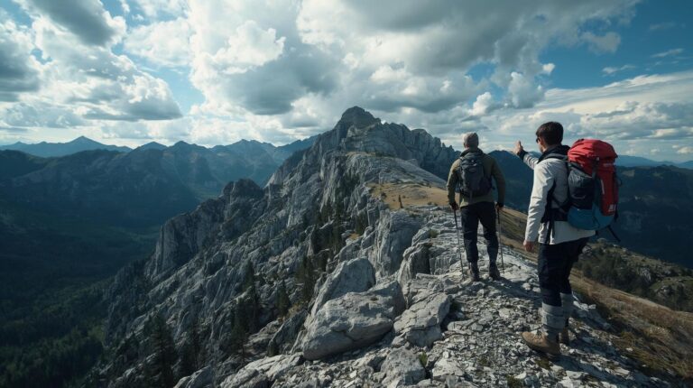
Level 5: Extreme / Dangerous (Black) ⚠️
Narrow rock edges, precipices, sections with metal ropes. Absolutely forbidden for people with a fear of heights or in bad weather!
- Premkata Saddle – Banski Suhodol Peak (The horse): The emblem of extreme tourism in Bulgaria. A rocky edge, 50 cm wide in places, with a metal rope and precipices on both sides.
- Vihren Peak – Kutelo Peak (via Premkata): A very steep descent from Vihren to the saddle on very slippery and crumbly marble.
- The Guards (Traverse): Note: It is not officially marked, but it is legendary. It requires insurance or professional mountaineering experience.
- The traverse H. Yavorov – H. Vihren (via Koncheto): The toughest one-day route in the mountains. A test of will and physique.
Part 2: Ranking by LENGTH
Times are approximate for an average pace during the summer season, not including long lunch breaks.
| Category | Time (direction) | Sample routes |
|---|---|---|
| Shortest | 15 min – 1 hour | Baykusheva mura, Lake Okoto, Popina Luka, Bezbog Peak (fast pace) |
| Short | 1 – 2.5 hours | H. Vihren – Muratovo Lake, H. Bezbog – Popovo Lake, Spano Pole |
| Half-day | 2.5 – 4.5 hours | Climbing Vihren Peak, H. Sinanitsa, Polezhan Peak, Tevno Lake (from Bezbog) |
| All-day | 5 – 10 hours | The traverse through Koncheto, Popina Laka – Tevno Lake, H. Bezbog – H. Demyanitsa |
The Great Pirin Traverses
For the most ardent mountaineers who want to feel the true spirit of Pirin, there are so-called traverses – multi-day treks crossing the mountain.
1. The Royal Traverse (On Route E-4)
This is the “backbone” of Pirin. It is most often done along a route Yavorov Hut – Vihren Hut – Tevno Lake – Pirin Hut – Melnik. It requires 3-4 days and excellent logistics, as the starting and ending points are far apart.
2. The diagonal traverse (East – West)
It connects the Dobrinishte lift with the Marble Peak. The route is: Bezbog Hut – Tevno Lake Shelter (overnight) – Vihren Hut. This is the most popular option for a weekend hike in the high mountains.
🎒 Necessary equipment for the high Pirin
Regardless of which of the described routes in Pirin you choose (except the green ones), do not underestimate the mountain. Pirin is known for its sudden weather changes.
- 🥾 Shoes: High, ankle-length, with a hard sole (Vibram). Sneakers are dangerous on marble.
- 💧 Water: There is no water in the marble section (Vihren, Koncheto)! Bring at least 2 liters per person.
- 🧥 Clothing: A windbreaker and raincoat are mandatory even in August.
- 📱 Navigation: A charged phone with an offline map (e.g. BGMountains or Maps.me) and an external battery.
The mountain awaits you! Choose your routes in Pirin wisely and enjoy the majesty of the peaks.