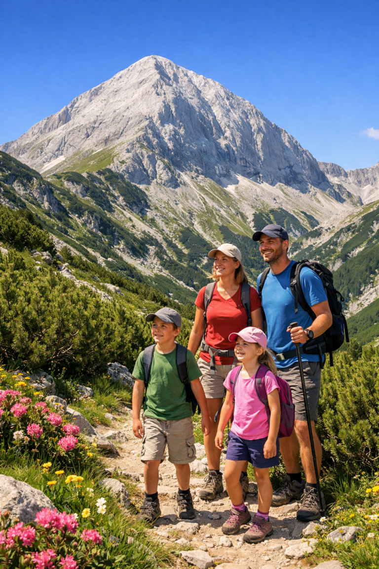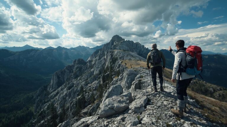
This trek is not just a walk, but a real expedition. The crossing of route Vihren – Popovi Livadi is part of the legendary European road E4 and represents the backbone of the Pirin Mountains. It is a journey that connects the marble north with the granite center and the green southern slopes, offering tourists crystal lakes, sharp peaks and centuries-old forests. Prepare for a serious physical challenge.
📊 Technical data (Full transition)
The data are aggregated for the entire traverse (2 days recommended).
🔍 Interesting facts about the route
- Geological phenomenon: The route crosses the “Main Gate” of Pirin, where the border between the white marble and the dark granite is clearly visible.
- The highest lake: Near the route (below Polezhan Peak) is the Upper Polezhan Lake - the highest lake in Bulgaria (2710 m above sea level).
- Historical trail: Part of the route coincides with old haidush paths and routes used by the Karakachans in the past.
🚗 How to get there? (Logistics)
This one route Vihren – Popovi Livadi is linear, which makes logistics more complicated than circular routes. Here's how to plan it:
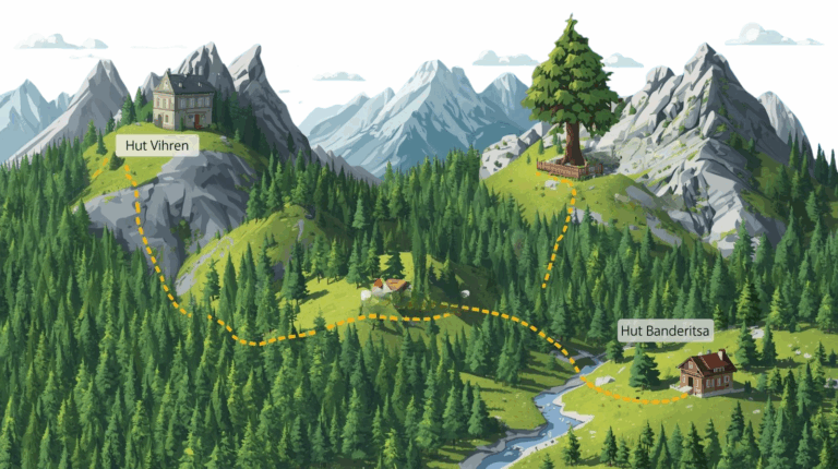
1. Start: Vihren Hut
- By car: Parking in front of the chalet is very limited. During the summer season (July-August) the road from Bansko closes between 09:00 and 16:00.
- Transportation: It is recommended to leave the car in Bansko and use the minibuses leaving from the bus station or the starting station of the lift.
- On foot: The start is from the emblematic fountain in front of the hut, following the red marking.
2. Final: Popovi Livadi Hut
- Location: It is located on the “Popovi Livadi” pass above the town of Gotse Delchev.
- Retracting: You must arrange transportation (a friend or taxi) from Gotse Delchev in advance, as public transportation from the pass itself is irregular.
🥾 Detailed description of the stages
Due to its length, we divide the description into two logical days with an overnight stay at a shelter. Tevno Lake.
Day 1: Vihren Hut – Tevno Lake Shelter
This is the classic hike through the heart of Northern Pirin. From the hut you head up along the river. You have two options:
- Through Banderishki Lakes (Classic): The path is picturesque, passing by the Fish and Long Lakes. There is a steep climb to the Bashliyska Gate.
- Through the Typics (Panoramic): For the more experienced. You climb high up the ridge, passing through the rocky peaks of the Tipits. The views are stunning.
Both options converge before the junction – Prevalski Chukar. There is a metal rope here that helps in crossing the rocky edge. The descent to the circus of Tevno Lake is steep and rocky.
Day 2: Tevno Lake – Polezhan Peak – Popovi Livadi
The hardest day. Getting up early (around 6:00 a.m.).
The detour to Polezhan Peak
From the shelter, head east to the Right Royal Palace Gate. Leave your heavy backpacks here (hide them behind the rocks) and make an “attack” on Polezhan peak (2851 m). The climb is over large stone blocks (moraines). The view from the top is probably the best in the entire Pirin – you can see almost all the lakes and peaks.
The descent to South Pirin
Once you return to the main trail, continue south through the Left Kralevdvorska Gate. You descend into the valley of the Zhelezina River to the Pirin Hut. This is the place for a long rest and lunch.
The last stage of Pirin hut near Popovi Livadi is a test for the psyche. The trail enters the forest belt, becomes more gentle, but is extremely long (about 4-5 hours just this section). It passes through the area of “Kriva sospa” and dense coniferous forests before you reach the asphalt at Popovi livadi.
🏠 Accommodation along the route
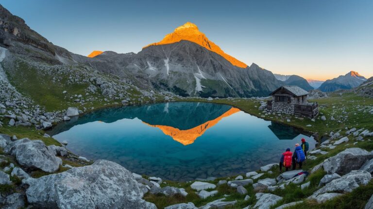
ℹ️ Base camp: Tevno Lake Shelter
A cult place for every mountaineer. It is located at 2512 m above sea level.
- 💡 Tip: The reservation is absolutely mandatory 2-3 months early for weekends!
- ✔️ Kitchen: They offer the legendary lentils and beans, as well as omelettes.
- 🛏️ Places: Common pomegranates. Bring your own sleeping bag (liner) for hygiene.
- ⚡ Current: There are solar panels for charging phones (USB), but don't count on the 100%.
ℹ️ Final: Popovi livadi hut
An excellent base for recovery after the difficult transition.
- 🛏️ Conditions: The chalet has been renovated and offers conditions close to those of a hotel.
- 🚿 Bathroom: There is hot water – a luxury after two days in the mountains.
- 💸 Food: Full menu, grill and cold beer.
🎒 Required equipment
This is no walk in the park. Lack of equipment can be fatal.
- Shoes: High mountain shoes with a hard sole (due to the rocky terrain).
- Clothes: Membrane (Hard shell) against wind and rain. Even in summer at 2800m, temperatures drop sharply.
- Water: At least 2.5 liters capacity. The water sources between Tevno Lake and Pirin Hut are few.
- Navigation: Charged phone with offline map (Karnoburg / OruxMaps) and external battery (Power bank).
- Sticks: Mandatory for relieving the knees during high elevation changes.
⚠️ Important to know (Safety First)
- Communication: The coverage of mobile operators is fragmented. There is a good signal on the peaks and ridges, but in the cirques (Tevno Lake) it is often completely absent.
- Dogs: On the route to Popovi Livadi there are herds of sheep and cows guarded by shepherd dogs. Be careful and do not cross the middle of the herd.
❓ Frequently Asked Questions (FAQ)
Q: Can I cover the Vihren – Popovi Livadi route in one day?
A: Theoretically it is possible for ultramarathoners (Sky runners) who complete the course in 7-9 hours. For a backpacker this is impossible and dangerous.
Q: Is there drinking water on Tevno Lake?
A: Yes, there is a spring (fountain) right next to the shelter, but the flow rate decreases at the end of summer.
Q: Is it suitable for beginners?
A: Absolutely not. You must have experience with at least 8-hour hikes and good orientation.
🗺️ Nearby routes
- Kamenitsa Peak – the majestic guard over Lake Tevno.
- The horse – the extreme edge in the Northern Hemisphere.
- Bezbog Peak – accessible by lift, a good alternative.