
This guide will help you choose the most appropriate digital tool for your needs by analyzing the 7 most popular navigation platforms in Bulgaria and around the world.
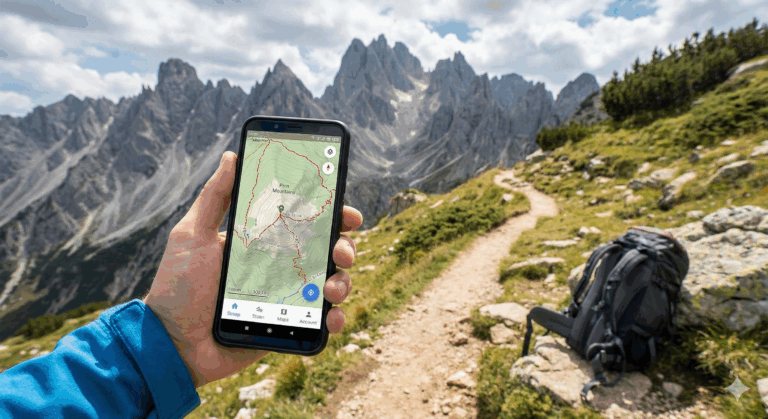
Why is it critical to have a mountaineering app?
Before we dive into the details, let's recall why digital navigation is indispensable in Pirin:
- Offline maps: The mobile connection on the way to Vihren Peak or Tevno Lake often disappears. Pre-downloaded maps are your only chance for orientation.
- Real-time GPS tracking: Even with zero range, your phone's GPS chip knows your exact location on the map.
- Safety: Apps help find the nearest shelter or water source in critical situations.
A detailed review of the top 7 apps for 2026
1. AllTrails – The Leader in the Global Community
AllTrails is probably the most recognizable name among hikers in Bansko, especially among foreign tourists.
- Platforms: iOS and Android
- Price: Free version / AllTrails+ for $35.99/year
- Memory: ~50 MB (plus space for downloaded maps)
Features of the free version: Access over 400,000 routes, search by filters, view photos and community reviews, record activity.
AllTrails+ features: Download offline maps, 3D visualization, “Lifeline” (sharing position with loved ones), warnings when deviating from the path.
Advantages: Extremely intuitive interface and up-to-date reviews about the condition of the trails in Pirin.
Disadvantages: Offline navigation is locked behind a paid subscription.
Recommendation: Best for discovering new trails and for intermediate hikers.
2. Komoot – The Choice for Precise Planning
This application stands out for its routing algorithms based on activity type.
- Platforms: iOS and Android
- Price: Free version / Paid regional packages ($3.99 – $29.99)
Features of the free version: Route planning and one free region for offline use (you can choose Blagoevgrad/Bansko).
Paid version: Voice navigation, detailed topographic maps, hourly weather forecast for the specific route.
Advantages: The best voice navigation on the market, ideal for multi-day hikes.
Disadvantages: There is no interface in Bulgarian; specific system for purchasing regions.
Recommendation: Ideal for hikers who want to hear directions without taking their phone out of their pocket.
3. Gaia GPS – For true professionals
If you are looking for the “Swiss Army Knife” of maps, Gaia GPS is your app.
- Price: Free / Premium ($19.99+/year)
- Memory: ~30 MB for the base application
Features of the free version: Route recording, waypoint marking, base layers.
Premium membership: Access over 250 professional maps, including historical and specialized topographic layers.
Advantages: The most detailed topographic maps for terrain analysis.
Disadvantages: Complex interface that takes time to get used to.
Recommendation: For experienced mountaineers and people planning expeditions outside the marked trails.
4. Hiker.bg – The local expert for Bulgaria
Developed by Zhivko Vassilev, this application is focused entirely on the Bulgarian mountains.
- Platforms: iOS (main)
- Price: Free
- Memory: ~146MB
Features: Offline maps for all Bulgarian mountains, information about the huts in Pirin, import of GPX files.
Advantages: The only application with such detailed information about huts and shelters in Bulgaria in Bulgarian.
Disadvantages: Lack of Android version (currently) and more outdated design.
Recommendation: A must for every mountaineer in Bulgaria with an iPhone.
5. OsmAnd – Full power in offline mode
The open source application that offers perhaps the highest degree of customization.
- Platforms: iOS and Android
- Price: Free / Pro (~$14.99/year)
Features of the free version: Offline maps of the whole world, object search, planning.
OsmAnd Pro: 3D terrain, weather forecast on the map, cloud backup.
Advantages: Everything works without the internet; huge customization options.
Disadvantages: It can be daunting for beginners because of the thousands of settings.
Recommendation: For tech-savvy users who want free and powerful offline navigation.
6. Organic Maps – Simplicity and Privacy
The spiritual successor to the old Maps.me, Organic Maps is fast, lightweight, and completely free.
- Price: Completely free
- Memory: 100-400 MB per region
Features: Offline maps, elevation profiles, no ads, no tracking.
Advantages: Very fast charging and easy to understand interface. Saves battery.
Disadvantages: Fewer social features compared to AllTrails.
Recommendation: Ideal for people who just want a “working card” without unnecessary extras.
7. Maps.me – The Traditional Choice
Although it is more commercial, it remains popular because of its simplicity.
- Platforms: iOS and Android
- Price: Free with in-app purchases
Features: Offline search, planning, thousands of POIs (points of interest).
Advantages: Very easy to use for navigating to chalets or hotels.
Disadvantages: Lots of ads and less detailed trails compared to Organic Maps.
Recommendation: For hikers who stick to the main trails and are looking for easy orientation.
Mountaineering app comparison table
| Application | Offline Maps | Language (BG) | Complexity |
|---|---|---|---|
| AllTrails | Paid | No | Low |
| OsmAnd | Free | Yes | High |
| Hiker.bg | Free | Yes | Low |
| Organic Maps | Free | Yes | Low |
Expert safety tips in Pirin
As specialists in the Bansko region, we advise every tourist not to rely on 100% technology alone. Here are a few golden rules:
⚠️ Prepare your smartphone
- Download the maps in advance: Do it at home or at your hotel in Bansko before you set foot on the mountain.
- Airplane mode: In the mountains, the phone is constantly searching for coverage, which “eats” the battery. “Airplane” mode retains the GPS function, but saves power.
- External battery (Power Bank): A must-have accessory. The cold reduces battery capacity drastically.
- The application of the PESS: Install the official Mountain Rescue Service app. It's the fastest way to send an SOS signal with location.
Final tips for tourists in Bansko
The choice of mountaineering apps depends on your experience. Start with Organic Maps for a reliable offline map and AllTrails for exploring the trails. If you are in Pirin for more than a day, also check out Hiker.bg for information about the huts.
Are you planning a hike in Pirin?
Let your adventure begin in Bansko! Check out our guides for the best routes and places to stay.