
Whether you're taking a leisurely stroll around Bansko or attack The horse, you need to know where you are at all times. Here's how to combine classic with modern technology.
The Paper Map: The Classic That Never Loses Reach
Many beginners consider paper maps to be obsolete. This is a dangerous misconception. Batteries die (especially quickly in the cold in the highlands of Pirin), screens break, and the GPS signal can be inaccurate in deep canyons.
Why do you need paper?
- The big picture: Your phone screen only shows a small square. The paper map gives a full overview of the terrain, emergency paths, and neighboring huts.
- Reliability: It works without electricity, without satellites and does not freeze at -10 degrees.
- Orientation: In combination with a compass, the map allows you to determine the azimuth and find your way even in zero visibility (fog) when you cannot see the next stake from the winter marking.
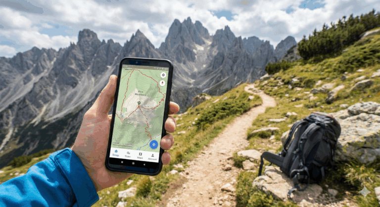
Digital navigation in the mountains: GPS and Apps
A smartphone is a great tool, as long as it's not your only source of information. To turn it into a full-fledged GPS device, don't rely on Google Maps - it's extremely unsuitable for mountainous terrain, as it doesn't show trails and terrain.
Top apps for Bulgaria:
- BGMountains / OruxMaps: For Android users, this is the “gold standard.” It uses the detailed BGMountains map, which is updated by enthusiasts and even shows water fountains, shelters, and dangerous areas.
- where.si: An excellent web-based map that can also be used offline through various applications.
- Komoot / Strava: Good for planning routes and recording tracks, but be careful – they rely on user data and sometimes the “path” may just be a goat trail.
Energy Independence: The Battery Rule
The most common mistake when using electronic mountain navigation is battery depletion. Cold is the number one enemy of lithium-ion batteries.
| Device | Problem in Pirin | Solution |
|---|---|---|
| Smartphone | The battery drops from 40% to 0% in minutes in cold weather. | Keep it in an inside pocket, close to your body. Turn on airplane mode. |
| External battery (Power Bank) | It's heavy, I forget. | A must-have piece of equipment! Minimum 10,000 mAh. |
True navigation is a combination of skills and tools. Learn to read the terrain, follow the markings (summer and winter), and use your phone for confirmation, not as your sole guide. The mountain is beautiful, but it does not forgive the disoriented.