
Are you looking for one of the most diverse and visually stunning hikes in Pirin? Route No. 8 is your adventure. It will take you from the popular Vihren hut to the fabulous Sinanishko Lake and the hut of the same name. Along the way, you will admire the crystal Muratovo Lake, overcome the harsh Banderishka Gate and experience the magic of the pink marble, characteristic of Sinanitsa Peak. Here is everything you need for your perfect preparation.
8. ROUTE No. 8 — Vihren hut – Sinanitsa hut„
📊 Technical data (Telemetry)
- ⏱️ Duration: About 4 hours – 4 hours 30 minutes (one way, without long breaks)
- 📏 Distance: About 6.5 – 7 km
- 🔥 Calories: ~1200 – 1500 calories
- 🚶 Avg. speed: ~1.8 km/h (variable terrain with steep sections)
- ⛰️ Min/Max height: 1950 m / 2500 m (at Banderishka Gate)
- 📈 Elevation: +550 m ascent / -360 m descent
- 🔵🟡 Marking: Blue to Muratovo Lake, blue/yellow to Banderishka Gate, blue to Sinanitsa Hut
- ⚠️ Difficulty: 4/6 (Medium to High)
💡 Interesting information
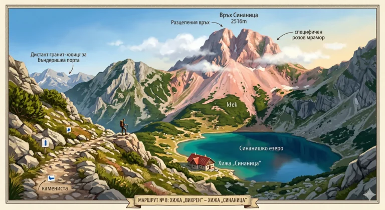
- Sinanitsa Peak (2516 m) is also known as The Cleft Peak or The Blue Peak. It is built of a specific pink marble, which gives it an incredible color at sunset.
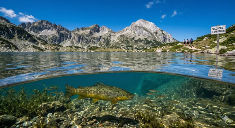
- Sinanishko Lake is one of the deepest in Pirin (up to 11.5 m) and impresses with its deep blue, almost turquoise color.
- Sinanitsa Chalet is located literally on the shore of the lake, making it one of the most picturesque chalets in Bulgaria.
🚗 How to get there? (Logistics)
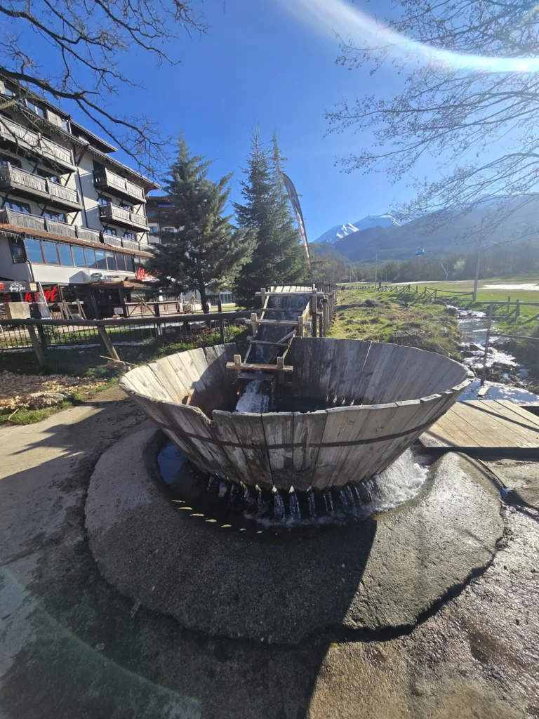
The starting point of the transition is Vihren hut„ (1950 m above sea level). A 16-kilometer asphalt road leads to it from the city Bansko. During the summer season (usually from July to mid-September) the road for private cars is closed in the area. The Shiligarnika to the chalet between 08:00 and 16:00. The most convenient and ecological option is to use the regular shuttle buses that leave from the bus station in Bansko, or to park at Banderishka meadow and continue on foot (about 1 hour).
🥾 Description of the route
1. From Vihren hut to Muratovo lake
The hike begins with a gentle climb along the left bank of the Banderitsa River. You walk through beautiful meadows and meadows. After about 45-50 minutes you will reach the picturesque Muratovo Lake (2230 m above sea level). Here you must stop for photos - the Todorka peak reflected in the water is one of the emblems of Pirin.
2. Climb to Banderishka Gate
After the lake comes the steepest and most exhausting part of the route. The path starts sharply up a rocky slope and scree. About 270 meters of positive elevation gain are overcome in about 1 hour and 15 minutes. The exit at the Banderishta Gate (2500 m above sea level) reveals phenomenal views of the Spanopolski Circus and the surrounding peaks.
3. Traverse to Sinanishka Gate
From Banderishka Gate the trail continues west. The terrain becomes flatter, but mostly rocky. The slopes of Georgiytsa Peak are cut through, and on the way you will see the beautiful Vlahini Lakes on the left. After about an hour of walking you reach Sinanishka Gate (2420 m above sea level).
4. Descent to the Sinanitsa hut„
From the Sinanishka Gate, you can enjoy a fabulous view of the circus and the lake of the same name. All that remains is a steep but short descent (about 40 minutes) along a rocky path to the hut itself, which awaits you on the shore.
🛖 Basic information about the site (Sinanitsa Hut)
The hut is small, cozy and extremely popular in the summer, so advance booking is absolutely mandatory if you are planning an overnight stay.
- 📌 Tip: Try the hut's famous mekitsi or soups while enjoying the view of the lake.
- 🕒 Working hours: It is open mainly during the summer season (June - September).
- ☀️ Season: Best time to visit: July – September.
- 🛏️ Beds: It has about 50 beds in shared dormitories.
- 🐕 Dogs: Allowed in the area around the chalet, according to the owners' rules.
- ☎️ Reservations phone: 0899 168 038 (we recommend checking for an up-to-date number before leaving, as the coverage up there is weak).
⚠️ Important to know
The route is open all the time. Sun protection and a sufficient amount of water (at least 2 liters) are critically important. Water can be poured from the river just before Muratovo Lake, but after that there are no water sources until the Sinanitsa hut itself. Shoes with hard soles are mandatory due to the moraines and rocky sections around the gates.
❓ Frequently Asked Questions (FAQ)
Can I climb Sinanitsa Peak from the hut?
Yes! A steep path (marked with "stone men") leads from the hut to the summit. The climb takes about 1 hour in each direction and requires attention, especially in the rocky sections around the ridge.
Is there mobile coverage on the route?
The range is very variable. Around the Vihren hut and Muratovo Lake it is good, it is lost in the areas of the gates, and near the Sinanitsa hut itself it is often weak or completely absent.
Is the hike suitable for one day?
Yes, many tourists do it as a day hike (it takes about 8-9 hours to go and back). However, you need to leave early in the morning and be in good physical shape.