
Handbook summary: Jangal Peak is called the “King of the Polezhanskoto ridge”. With its 2730 meters, it is one of the most photogenic and respectable peaks in Pirin. This giant requires respect, good preparation and proper planning. In this article you will find everything – from the legends behind its name to a detailed description of the routes and the best places to stay around.
The majesty of Mount Jangal: Why climb it?
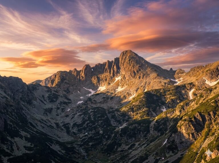
If you ask any experienced mountaineer or photographer which is the most beautiful peak in Pirin, the answer is often not the top Vihren, but rather Jungle (also known as Dzhengal). Located on the lateral Polezhansko ridge, it rises like an inaccessible granite tower between the Dzhengalska Porta saddle and Momin Dvor peak.
Its characteristic alpine profile, seen from the direction of Popovo Lake, inspires respect. Its slopes are steep, covered with massive boulders and scree, descending dizzyingly towards the cirques of the Valyavishki Lakes and the Samodiv Lakes. This is not just a peak that you “conquer” – it is a peak that tests you.
Technical passport of the top
| Characteristics | Details |
|---|---|
| Altitude | 2730 m.a.s.l. |
| Part of Pirin | Northern Pirin (Polezhno Ridge) |
| Difficulty (on a ten-point scale) | 7/10 (Summer conditions) |
| Nearest shelter | Shelter Tevno Lake |
| Water along the route | Missing in the high part (above the lakes) |
The Mysticism of the Name: Three Legends of Jangal
The name of the peak is as harsh and memorable as the mountain itself. Over the years, the socialist government has tried unsuccessfully to rename it “Golets” or “Samodivski”, but the people’s memory has preserved the original sound. Here are the three most popular versions of its origin:
- The legend of the lost lamb: The most common and lyrical version connects the name to a dialect word for a milk sheep (“jangal”) that has lost its lamb. Mountaineers say that when the wind whistles through the rocks at the summit, the sound resembles the sad bleating of a mother searching for her young.
- The deity of storms: Other researchers (including famous Pirin local historians) are looking for a more ancient root. According to them, Jangal is the name of an ancient evil deity or demon of Turkic origin, the lord of thunder and stone avalanches – something that fully corresponds to the character of the weather in this area.
- The Outlaw Jangal: The third version is more heroic and tells of a brave outlaw named Jangal Voivoda, who used the inaccessible rocks and caves around the peak and the Valyavishki Lakes as his refuge, from where he stalked the Turkish raiders.
Detailed description of the climbing routes
Access to Jangal Peak It is never easy. The peak has no “tourist path.” All routes require attention, sturdy shoes, and experience in crossing moraines (stone rivers).
1. “Classic” Route: From Tevno Lake Shelter
This is the most commonly used approach, as it is the shortest and most logical if you are making a transition across the ridge.
- Starting point: Tevno Lake Shelter (2512 m).
- Duration: 1 hour and 15 minutes to 1 hour and 30 minutes (uphill).
- Marking: Unofficial (orange or red dots on the stones, stone pyramids).
- Description of the terrain: You start from the shelter in an easterly direction. The trail gains altitude towards the saddle between Valyavishki Chukar Peak and Momin Dvor. Then it descends slightly to intersect the jagged rock ridge. The most important point is not to try to climb the ridge directly from the very beginning, but to go around it from the Valyavishki Circus (northwest) until you reach its northern side. The final attack is steep, but without technically difficult squirrel passages.
2. “Endurance” Route: From Bezbog Hut
This route is a favorite of day hikers, but it is a test of physical fitness due to its length.
- Starting point: Bezbog Hut (2240 m), accessible by lift from Dobrinishte.
- Duration: 4:30 – 5:00 (one way only!).
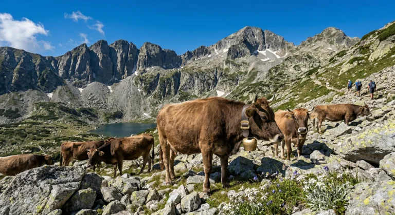
- Description: The trail follows the classic route to Popovo Lake. After passing the lake (leaving it on the left), you begin to climb through the circus. Here you should watch out for the fork to the Jungle Gate (there is a marking, but sometimes it is lost in the slush). The climb to the gate is steep and tiring. Once you step on the saddle, the view is stunning, but you still have to climb along the edge to the very top.
3. “Extreme” Route: Through the Jungle Gate (Direct)
This option is recommended. only for very experienced hikers. Passing through the Jungle Gate itself involves walking along a narrow, rocky ledge with precipices on both sides. Not suitable for people with a fear of heights!
Where to stay? Cabins and shelters in the area
Since the transition to Jangal Peak is usually long, strategic choice of a place to stay is key. Here is detailed information about the nearest bases:
🏠 Tevno Lake Shelter (2512 m)
Distance to the top: ~1.5 hours.
Conditions: This is the highest shelter in Bulgaria with a permanent presence. It offers food (the legendary meatballs and beans), drinks and pomegranates for sleeping. There is no running water inside (an outside fountain or the lake is used). The toilet is outside. Electricity is from a generator and solar panels (limited to charging phones).
Tip: Reservations are absolutely essential weeks in advance, especially for weekends in August!
🏠 Bezbog Hut (2240 m)
Distance to the top: ~5 hours.
Conditions: A large, massive building on the lake shore, right next to the upper station of the lift. It offers rooms with private bathrooms and dormitories. It has a large restaurant, Wi-Fi and all the amenities of a hotel. It is ideal for families or groups who want comfort before the difficult hike.
🏠 Demyanitsa Hut (1895 m)
Distance to the top: ~4-5 hours (via Valyavishki Lakes).
Conditions: It is located in the forest belt, at the confluence of the rivers. It is accessible on foot from Bansko (about 4 hours on a forest road). The hut is cozy, offers delicious food and is an excellent starting point if you want to approach Jangal from the Valyavyshki Lakes side, avoiding the crowds of Bezbog.
Location and Navigation
Planning the route starts with the map. Jangal Peak is located in the heart of the reserve “Yulen. To find your way around Bansko and Dobrinishte more easily, use the link below:
🗺️ Open Jangal Peak in Google Maps
*Click the button for accurate GPS coordinates and terrain visualization.
The Panorama: The Reward for Effort
When you reach 2730 meters above sea level, fatigue disappears instantly. In clear weather Jangal Peak offers a 360-degree panorama, which many consider to be the best in Pirin:
- North: The view reaches the Vihren peak and the marble ridge of Kutelo and Banski Suhodol.
- East: Polezhan and Strazhite are clearly visible – one of the most difficult sleepers in the mountains.
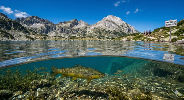
- The lakes: This is the most impressive part – at your feet the blue waters of Tevno Lake, Valyavyshki Lakes and the huge Popovo Lake with its island shine like eyes.
Expert safety tips
⚠️ Warning! Pirin does not forgive mistakes
- Without water: There are no water sources after the lakes. Bring at least 2-3 liters of water per person.
- Lightning: Jangal is the “lightning rod” of the area. At the slightest sign of a storm, immediately descend to the valleys!
- Insurance: Mountain insurance is mandatory. Rescue operations in this area are extremely difficult and expensive.
- Equipment: Even in July and August, it can be 5 degrees at the top with strong winds. A windbreaker and fleece are a must in your backpack.
The ascent of Jangal Peak is an emotion that lasts a lifetime. This is a peak for connoisseurs – those who are not just looking for height, but for beauty, wildness and a connection with the mountain. Prepare well and Pirin will reward you with views that no camera can fully capture.